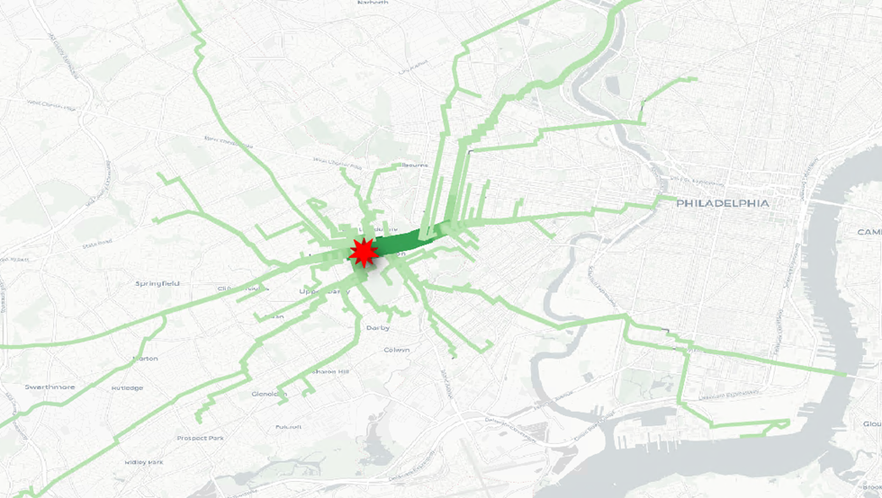
Have you ever wondered how customers may have gotten to your store? Are you trying to better understand the catchment of your store, but unsure how to do that? Are you trying to decide if billboard advertisements make sense to you? I developed a tool called...
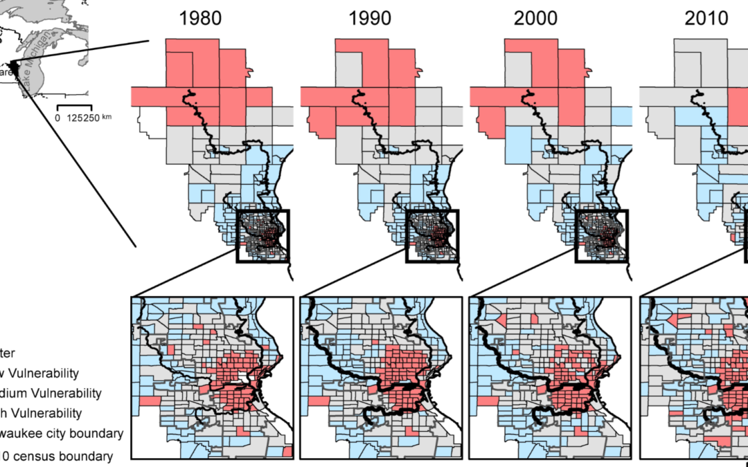
Our world is defined by systems– economic, social, political. Understanding these systems is a key part to better understand our world. I worked as part of a project evaluating the social vulnerability of sites within Milwaukee, WI, and Gary, IN. As...
In the early days of the COVID-19 pandemic, I volunteered with the Lake County Health Department to create a social vulnerability index based on the composite of the local community and the specific vulnerabilities we knew that communities would face in light of the...
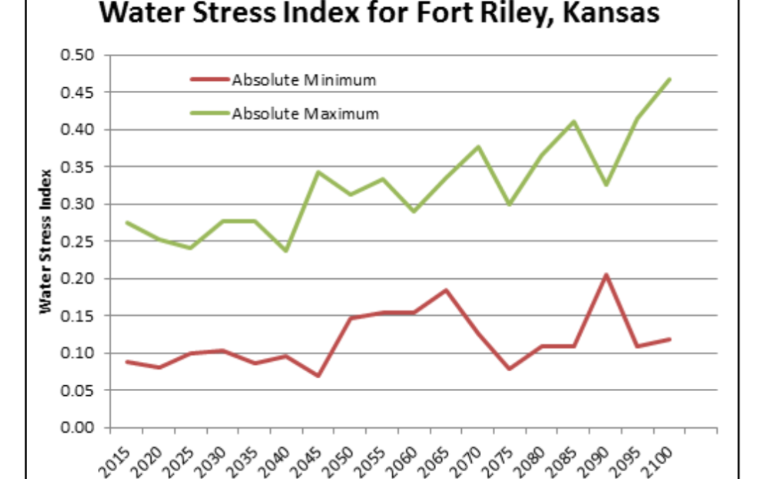
While working for the US Army Corps of Engineers I lead the development of a regional water balance model. This was a dynamic modeling project that looked at: Climate Change forecasts and available waterThe impact of urban development (by a base expanding) and...
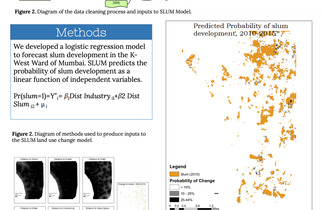
In 2015 I traveled to Mumbai, India, and did collaborative research with the Indian Institute of Technology, Bombay. In Mumbai, informal settlements are quite common and pose a challenge to urban planning. These settlements are only expected to continue to grow in the...